The New Blueprint: How Drone Data is Reshaping Preconstruction Planning
In the ever-evolving construction world, staying ahead of the curve isn’t just about adopting new tools—it’s about embracing a mindset of continuous innovation. The advent of drones in the construction industry exemplifies this shift, offering unprecedented advantages, particularly in the preconstruction phase. From precise site surveys to intricate 3D modeling, drones are transforming how project managers and other stakeholders approach the early stages of a project. Here we will explore how drones are revolutionizing preconstruction and why they should be a cornerstone in the toolkit of anyone involved in this critical phase.
The Expanding Role of Drones in Preconstruction
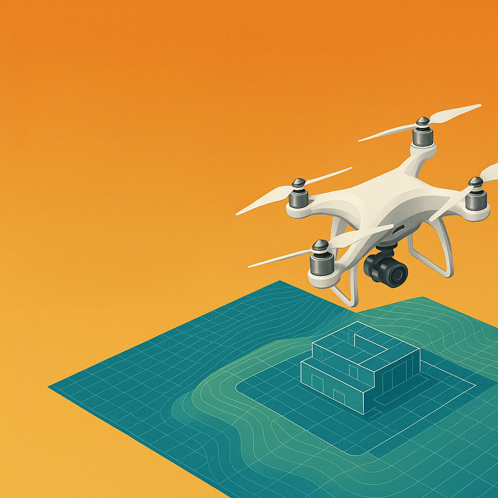
The preconstruction phase is where the vision for a project begins to take shape, setting the foundation for everything that follows. Traditionally, this phase has relied heavily on manual surveys, ground-based observations, and 2D plans. While effective to a degree, these methods are time-consuming, labor-intensive, and prone to human error. Drones, or unmanned aerial vehicles (UAVs), are now stepping in to fill these gaps, providing a comprehensive, real-time overview of construction sites that wasn’t possible before.
Imagine the typical process of site surveying. It’s a painstaking task that can take days, if not weeks, to complete, especially on large or complex sites. Survey teams must traverse the site on foot, using traditional instruments to measure and map the terrain. The process is slow and fraught with potential for oversight, particularly in areas that are difficult or dangerous to access. Drones change this dynamic entirely. Equipped with high-resolution cameras and advanced sensors like LiDAR, drones can swiftly cover vast areas, capturing detailed images and data that can be transformed into accurate topographic maps in a fraction of the time. The result? Faster decision-making, reduced labor costs, and a level of detail that was previously unattainable.
But drones don’t stop at simply surveying the land. They’re also revolutionizing how we visualize and plan construction projects. By capturing hundreds or even thousands of images from various angles, drones enable the creation of 3D models that offer a lifelike representation of the site. These models provide a realistic visualization of how the site will interact with the planned structures, offering insights that are invaluable during the design and layout stages. For project managers, these 3D models aren’t just a fancy tool—they’re a powerful asset that can uncover potential issues early, allowing for adjustments before construction begins. This level of foresight is crucial in avoiding costly delays and ensuring that the project stays on track.
Another area where drones are making a significant impact is in volumetric analysis, particularly in projects involving earthwork. Accurately estimating the volume of materials to be moved is a critical aspect of budgeting and scheduling. Traditionally, these estimates could be off, leading to over-ordering or underestimating resources, both of which could impact the project timeline and costs. Drones eliminate this uncertainty by providing precise volumetric measurements, ensuring that project managers have the data they need to make informed decisions. This accuracy not only saves time and money but also reduces the risk of resource-related delays.
The Tangible Benefits for Project Managers and Stakeholders
The integration of drones into the preconstruction phase offers a plethora of benefits, especially for project managers who are often under pressure to deliver on time and within budget. One of the most immediate advantages is the significant time savings. Where traditional site surveys might take weeks, drones can complete the same tasks in a matter of hours, providing real-time data that can be analyzed and acted upon immediately. This efficiency is a game-changer, allowing project managers to focus on other critical aspects of the project without being bogged down by time-consuming tasks.
Moreover, the quality of data collected by drones enhances decision-making at every level. High-resolution images, accurate topographic maps, and detailed 3D models provide a clear picture of the site, enabling project managers to identify potential challenges before they become problems. For instance, drones can reveal issues like uneven terrain, drainage problems, or existing infrastructure that might interfere with construction. Addressing these issues during the preconstruction phase, rather than after construction has started, can prevent costly changes and ensure the project remains on schedule.
The cost-saving potential of drones extends beyond just time efficiency. By providing precise data quickly, drones reduce the need for repeated site visits, which in turn cuts down on labor costs. Furthermore, accurate volumetric analyses ensure that material estimates are spot-on, preventing over-ordering and minimizing waste. For project managers working within tight budgets, these savings can make a substantial difference, freeing up resources for other aspects of the project.
But the benefits of drones aren’t just about efficiency and cost—they also improve communication and collaboration among all stakeholders. One of the challenges in construction is ensuring that everyone, from architects to clients, is on the same page. Drones help bridge this gap by providing visual data that’s easy to understand, even for non-technical stakeholders. Sharing 3D models, aerial imagery, and other data collected by drones allows for better collaboration, ensuring that everyone involved in the project has a clear understanding of its scope and potential challenges.
Safety is another critical area where drones shine. The construction industry is inherently risky, with workers often required to access hard-to-reach or dangerous areas. Drones mitigate this risk by performing inspections and surveys in these areas without putting human lives at stake. For project managers, this means fewer safety concerns and a reduced likelihood of accidents, leading to a safer work environment and fewer disruptions to the project timeline.
One of the more forward-thinking benefits of drones is their ability to provide real-time monitoring of site conditions. Construction sites are dynamic environments where conditions can change rapidly due to weather, environmental factors, or unforeseen circumstances. Drones can quickly resurvey a site and update the data, allowing project managers to make real-time adjustments to plans. This adaptability is crucial in keeping the project on track, especially in the face of unexpected challenges.
Beyond the immediate benefits, drones also offer long-term advantages through enhanced site documentation. Every flight a drone takes is another opportunity to create a comprehensive visual record of the site’s progress. This documentation is invaluable for resolving disputes, verifying compliance with regulatory requirements, and providing a historical record for future reference. In the event of any discrepancies or challenges, having detailed, timestamped drone footage can serve as a critical point of reference, protecting the project and its stakeholders.
Overcoming Challenges and Looking Ahead
While the advantages of using drones in preconstruction are clear, it’s important to acknowledge the challenges that come with adopting this technology. Regulatory hurdles, for instance, can be a significant barrier, particularly when it comes to obtaining the necessary permits for drone flights. However, as drone technology continues to advance and the industry becomes more accustomed to its use, these barriers are steadily diminishing. It’s also worth noting that the initial investment in drones and the necessary software may seem steep, but the return on investment, in terms of time saved, costs reduced, and improved project outcomes, quickly justifies the expense.
Looking ahead, the use of drones in preconstruction is expected to become increasingly standard practice. As the construction industry continues to digitize and embrace new technologies, drones will play a pivotal role in driving efficiency, enhancing safety, and improving overall project outcomes. For project managers and other stakeholders who are willing to invest in and embrace this technology, the competitive advantages will be significant. The ability to make smarter, data-driven decisions from the outset sets the stage for a successful project, reducing the likelihood of costly surprises down the line.
Conclusion
Drones are not merely a technological novelty—they are a practical and powerful tool that can fundamentally transform the preconstruction phase of any project. For project managers, architects, engineers, and other stakeholders involved in preconstruction, drones offer an unprecedented opportunity to enhance efficiency, improve decision-making, and mitigate risks. By integrating drones into your preconstruction processes, you’re not only embracing innovation but also setting your projects up for success from day one.
In an industry where the margin for error is slim, and the stakes are high, drones provide the precision, speed, and insight needed to stay ahead. The future of construction lies in smart, data-driven decisions, and drones are leading the way. Don’t let this wave of innovation pass you by—explore how drone technology can elevate your preconstruction phase and drive better outcomes for your projects. The future is in the sky, and it’s time to take flight.
📌 FAQ: Drones in Preconstruction
Q: What role do drones play in preconstruction?
A: Drones capture aerial imagery and terrain data, enabling faster, safer, and more accurate planning before construction begins.
Q: How accurate are drone-based construction surveys?
A: With RTK GPS and LiDAR, drone surveys can achieve sub-inch to centimeter-level accuracy, depending on sensor type and conditions.
Q: Do drones reduce preconstruction costs?
A: Yes, by replacing manual surveys and reducing rework, drones can significantly lower costs related to labor, materials, and delays.
Q: Is drone data useful for project documentation?
A: Absolutely. Drones create timestamped records of site conditions, ideal for compliance, progress tracking, and resolving disputes.